The Dog River rules, not the zoning district, set the density
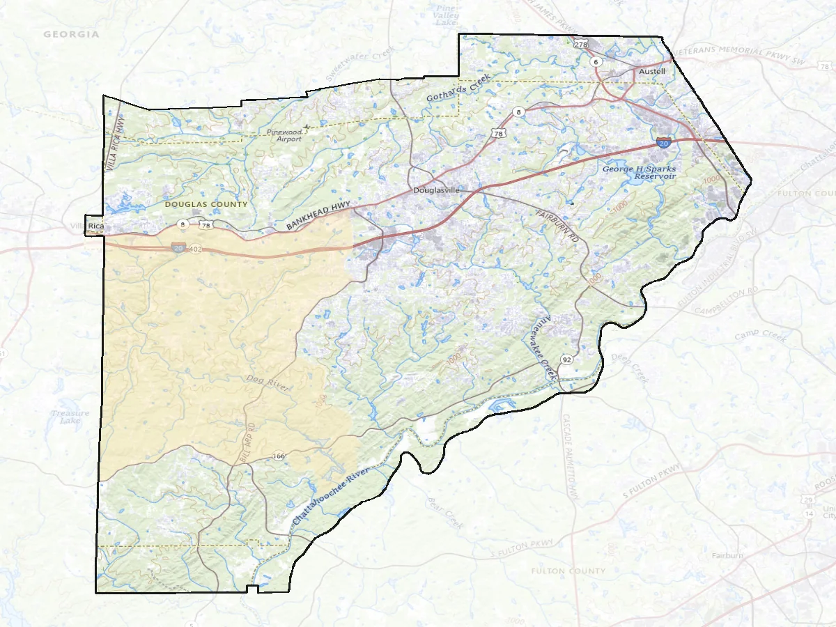
The county's code puts all land in unincorporated Douglas inside the Watershed Protection Overlay District and divides it into nine areas drawn on the official zoning map along the drainage basins: the Dog River, Bear Creek, Anneewakee, Sweetwater in three parts, Hurricane, and the Chattahoochee direct drainage outside the corridor the state regulates separately. Which basin a parcel drains to is not trivia. It sets the stream buffer, the setback, and how much of the lot may be covered.
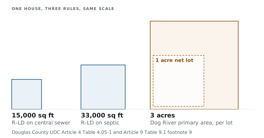
Dog River carries the strictest rules, because the Dog River Reservoir holds the county's drinking water. In the Dog River primary protection area the county requires a 200 foot natural vegetative buffer from the bank of a regulated stream and a 200 foot minimum setback for regulated activities, and the code counts impervious surfaces, septic tanks, drain fields, and even pasturing or grazing livestock as regulated activities. Impervious surface is capped at 18 percent of the lot, residential or commercial. Then the density rule: three acres of gross land area for every lot, and a net lot no smaller than 43,560 square feet with the same area buildable.
Set that beside the base zoning. The county's low density single-family district asks 33,000 square feet on septic and 15,000 on central sewer. In the Dog River primary area the watershed figure governs instead, so undivided land carries a fraction of the lots the same acreage would carry two basins over. If you have ever wondered whether your land could be split, that one rule is most of the answer, and it means a large-tract sale from outside the watershed is not evidence for a tract inside it however alike the frontage and the terrain look. Lots already platted keep what they were approved with, which is its own problem: the subdivision next door could not be built the same way today.
The boundary between the primary area and the secondary one runs off Interstate 20. The code puts the secondary area north of the interstate, plus a quarter-mile radius from an interchange south of it, and the primary area everywhere else in the watershed. That makes it a parcel-by-parcel matter rather than a neighborhood one, so I read it off the county's official zoning map for the property in front of me instead of inferring it from a subdivision name. The county's own basin layer puts River Walk, Windsor Creek, Bright Star Estates, Ansbury Park, Nolandwood Lake, The Falls at Mason Creek and Dog River Reserve among the unincorporated neighborhoods draining to the Dog River.